Thursday, April 30, 2009

Whales!

Our first destination today was the Klamath River Overlook, reputed to be a good spot for whale and seabird watching. When we arrived, a volunteer whale watcher was recording whale observations and chatting with two women. They pointed and exclaimed about seeing whales blowing and swimming quite near the shore at the mouth of the Klamath River and talked about having to "learn" to see whales--the importance of knowing what to look for. The observer was part of a project to record sightings of whale cows and calves on their northward migration, and she commented on the mother-calf pair she was watching.

The mouth of the Klamath River and its sandspit as seen from the Klamath River Overlook. Today whales were feeding just outside the mouth of the river.

Ken and I looked intently, but could see nothing. How frustrating! The others left, and we stayed patiently staring at the waves and trying to focus our binoculars. Suddenly both of us started to see whales. At least two calves were spy hopping--sticking their heads up to look around. Several times the whales swam up just under the surface and their backs cleared the water. It was as if they were putting on a show for us, and we watched for at least an hour.

Next we went to eat our picnic lunch while watching Roosevelt elk grazing in the meadow in front of us. Actually most of them were lying around lazily.

Our last destination was the Lady Bird Johnson Grove, where a ceremony dedicating the grove to Lady Bird marked the establishment of the Redwood National Park in 1968.

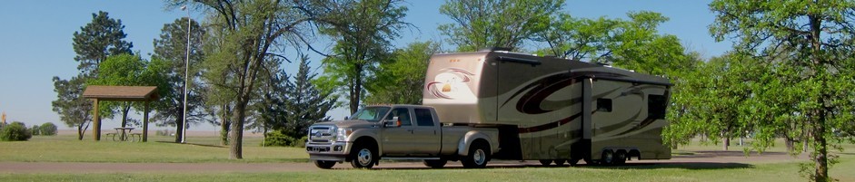
Here's our truck in the Lady Bird Johnson Grove parking lot. Trillium were blooming at a number of places along the trail in the grove.


For supper we had Sweet Potato Curry With Spinach and Chickpeas over brown rice (interesting, but I doubt I'll make it exactly that way again).
Read more!

Wednesday, April 29, 2009

Beach

This morning when I turned on my Garmin before starting out on a walk, it informed me that my altitude was 0 feet--not unusual for an RV park near the Pacific coast, but different from the mountain altitudes we drove through on the way to the coast. Crescent City, like Long Beach, is named for its beach, a broad crescent of sand. Later we walked out to the Battery Point Lighthouse, the privately-owned lighthouse out beyond Crescent City's pier.

The lighthouse grounds have more iceplant than we've seen in one place since we left Southern California. The lighthouse was open for touring, but we decided not to go in. We'll be seeing more lighthouses as we continue north.

This afternoon we drove to the Enderts Beach Overlook and took the Coastal Trail along the bluff and down to the beach. Along the way we enjoyed the vista of the Pacific waves below, when we weren't too concerned by the steep dropoff to notice. We saw lots of wildflowers and butterflies. Ken spotted a tiny active bird with a bright yellow breast, flitting about and singing in a tree overhead, but it wouldn't sit still long enough to have its portrait made.

Along the trail to the beach we walked past a lot of interesting trees, bushes, and ferns. This is the largest of the butterflies we saw, most spanned less than an inch.


On the beach we watched the seagulls and searched the sea for signs of migrating whales, but none appeared. Walking along the sand, seeing the waves sparkling in the sunlight, and listening to them crash into the shore was very restful.

We had Enderts Beach all to ourselves. Lee found a good rock at the edge of the water to relax on.


From where we parked our truck we had a good view of people fishing on Crescent Beach.


Sweetie is definitely better, though still being picky about her food. She's turning her nose up to the canned chicken chunks in gravy that she used to enjoy, but she will eat it if some tuna juice or chicken broth is added. I never thought I'd be cooking chicken for a dog! She is walking better and acting more energetic, too.

This morning Ken dropped me off at the Econo Wash and took the truck in for its third oil change. The Driver Information Center had informed us that we needed to "Change Engine Oil Soon"--an onboard computer keeps track of the mileage and driving conditions and determines when an oil change is needed. Good thing we don't need one every 3000 miles, since this one cost us $88.05.
Read more!

Tuesday, April 28, 2009

Travel to Crescent City

This morning we left the Eureka Elks Lodge and headed north. We stopped at the Thomas H. Kuchel Visitor Center at the Redwood National and State Parks (that's one National Park and three California State Parks, cooperatively managed as an ecological unit). We learned a lot from the exhibits and from the 12 minute orientation video. A helpful ranger made lots of good suggestions for things we might like to see and do and highlighted a map for us.

We've had a lot of cloudy weather lately, but very little rain. Hope our luck holds.

We are staying at Sunset Harbor RV Park, which is an Escapees discount park. It's a block off Hwy 101, so the traffic noise is not intrusive, but we can hear the foghorn and the sea lions barking in the Crescent City Harbor.

After lunch we drove around the campground at nearby Jedediah Smith Redwood State Park, thinking we might move there. It has a few campsites that might accommodate our rig, but the trees are large and close together and the roads are narrow and winding, so we decided to stay where we are.
Read more!

Sunday, April 26, 2009

Ferndale and the Avenue of the Giants

We started this morning with a trip to Ferndale, a Victorian town about 16 miles south of Eureka. The entire town is a California historical landmark. We strolled along the Main Street and visited the Ferndale Cemetery. Next to the cemetery an old church with large stained glass windows has been converted into private residences. Many shops were closed since it's Sunday--and the town may be experiencing the effects of the economic downturn, but we saw enough to be charmed.

One of the many Victorian homes in Ferndale. Lee got a kick out of the Itsy Bitsy Quilt Shop.

Next we headed south to travel the Avenue of the Giants. One of the interpretive panels quotes Steinbeck: "From them comes silence and awe . . ." We walked through the Founders Grove and saw the mighty fallen tree, the Dyersville Giant. Looking up to the dizzying heights the redwoods reach creates a cathedral atmosphere. Ken commented that he could spend a whole day taking photos there.

The Founders Tree-dedicated to those who founded the organization that made this grove possible. Lee measuring a tree in one of the memorial groves along the highway.

We'll see more redwoods as we follow the coastline north, so we headed home without seeing the entire Humboldt Redwoods State Park.

Sweetie seems to be doing a little better. At least she licked the gravy from her canned food, and I got her to swallow a bit of cheese with aspirin inside.
Read more!

Saturday, April 25, 2009

Eureka!

We've found it! The Eureka Elks Lodge, that is, where we are now parked. After two days out of contact via cell phone and internet, we are glad to be back in touch. I got two voicemails from Beth updating me on Aunt Iris's condition. I called and talked to Beth who had just brought her mom home from the hospital. She had a pacemaker installed yesterday and was doing better.

It is good to have Sweetie back, but she's not exactly 100% yet. She hasn't eaten anything, and she's having more trouble with her right rear leg again. We'll plan to take her to a vet when we get to Portland.

Just as I was parking the rig, Nanci called. Needless to say, I called her back after we had set up camp. She's a very busy woman! We caught up some on what we've been up to and talked about our upcoming visit. We'll get to square dance with their local group on Sunday, June 21--which just happens to be our 12th anniversary.

We have looked over some of the tourist info and planned some things to see and do in the Eureka area tomorrow and Monday.

For dinner we had chicken enchiladas, zucchini/corn, and black beans.
Read more!

Friday, April 24, 2009

The Search Continues

This morning I set out again to hunt for Sweetie, moving farther out from the camp and encountering lots of "Private, No Trespassing" signs, but I kept on. One man offered to refill my coffee and invited me into his small cabin, heated by a wood stove on which a percolator sat. He showed me the baby squirrels he and his wife were fostering after the tree that held their nest fell down. And he said that he would spread the word.

We paid for another night so we could continue the search. Ken and I walked all over the area again.

As the day wore on, I began to lose hope. We printed up Lost Dog posters and took them to the post office five miles east and to a Forest Service campground 1/2 mile west. We stopped at a river access sport east of the park and drove back in a rough rocky road and walked along the river. We called the local veterinarians and animal control, but no one had any news. I was imagining Sweetie stuck somewhere, so I looked carefully under all the cabins and trailers in the park and in every nook and cranny.

Move people were arriving at the park, since it was the beginning of the weekend. One man took his small dog and hunted for Sweetie for two hours. Everyone was concerned and promised to let us know if they saw her.

I found a way down to the river I hadn't seen before and looked along the banks. The path to the river made a switchback around a little meadow in a depression. I circled around and searched east of the campground again. Finally I folded up Sweetie's kennel and picked up her dishes. I was pretty sure I'd never see her again. I thought to myself that I might find her body, that perhaps she hadn't turned up because she'd gone off somewhere to die.

After supper I set out for one last search before dark. As it grew dark, I started back, and suddenly saw Ken waving his hands in the air and calling to me. Sweetie was home! Three of the teenage girls who'd been riding bikes around the campground had spotted her in a meadow down near the river (the very one I'd searched a couple of hours earlier) and rescued her. They hadn't even known there was a lost dog.

I went to find Sweetie's rescuer, who turned out to be a girl named Jasimine. She told me she had spotted Sweetie in the meadow near the river, and the other two girls had not wanted to go down to get her. Jasimine had climbed down into the meadow and had called "Come here, sweetie" as she got near. Sweetie was shivering but came over to Jasimine. As you can imagine, we were relieved and grateful to have our little dog back.

I took a thank you note and reward to Jasimine--we certainly owed her a lot of thanks! We went to bed with our little household intact again.
Read more!

Thursday, April 23, 2009

Lost Dog!

We left Redding this morning, heading on Hwy 299 towards Eureka on the coast. Hwy 299 is the Trinity Scenic Byway, and it extends 140 miles, but we planned to stop halfway across, at Del Loma RV Resort, and go on to Eureka on Friday. The drive was definitely scenic as we followed the winding road up and down through the mountains and along the Trinity River, but the curves and sheer drop-offs were also a bit nerve-wracking for the passenger (Lee). Ken remarked that it would be his turn to be nervous tomorrow.

We stopped in Weaverville at the Joss House, a historic Chinese temple. The original temple in this area was built by early Chinese immigrants who came to the area as part of the California Gold Rush. The current building, called the Temple of the Forest Beneath the Clouds, is very ornate and impressive.


Approaching the temple in the state park
Interior is rather dark, but extremely ornate


We arrived at the RV park just before lunch and were assigned a pull through at the back of the park, overlooking the Trinity River. No one else was in the area, so I decided to let Sweetie off the leash, since she'd been shut up in her kennel in the car for a couple of hours. We set up camp and fixed sandwiches while I kept an eye on her and moved her back near our rig a couple of times. Then we sat down at our picnic table to eat our sandwiches . I got up to locate Sweetie, but she was nowhere to be found. We immediately started to search for her, with no result. We figured she had to be nearby, since she is pretty slow moving, but after a while we spread the search out further.

The campground is in a forest with lots of manzanitas and it sits on a bluff overlooking the Trinity River. We reported our lost dog to the owner of the campground, who suggested that we go talk to his niece, who lives just west. Back from the road, where travelers would never see them, there are a variety of dwellings spread out in the forest, from small trailers to shacks to cabins to houses. The niece said that her three dogs were out and that Sweetie might come back with them. She said she'd spread the word among the neighbors.

Of course we also talked to the few others in the camp, but no one had seen her. We spent the next several hours combing the area, but no little dog appeared. As night approached, we hoped that she would find a warm nest among the pine needles, since it was quite chilly--and that no predators would find her. We'd been reassured that no mountain lions had been seen in the area for a couple of years, but there are definitely foxes and other critters.

Meanwhile I was concerned about my Aunt Iris. I'd gotten a message this morning that she had tripped and fallen down a flight of stairs at church and was in the hospital. Beth said that God must have pushed her--because it was discovered that her coumadin levels were sky high and her heartrate was unsteady. I asked Beth to call, but it turns out that there's no cell phone service here in the gorge.

I was feeling awful, worried about Sweetie and thinking that I was responsible for her predicament.
Read more!

Wednesday, April 22, 2009

Whiskeytown Falls Hike

We decided to stay over in Redding another night so we could spend some time at Whiskeytown National Recreation Area. The lake is just eight miles west of town, and there are several waterfalls. The best hike we found on the web was a 3.4 mile roundtrip to 220 foot Whiskeytown Falls.

We started out at 11 from the trailhead and soon found that much of the trail was uphill. Fortunately most of the trail was shaded and there was a nice breeze, so we didn't feel the full force of the 95 plus degrees, especially in the portions of the hike near the creek. We saw dogwoods in bloom at lower elevations, and lots of blooming manzanitas as we went uphill. The falls themselves were beautiful, and we got to enjoy them by ourselves. We passed a few other people on the trail, but were mainly alone, enjoying the pristine forest and the clear stream.


Afterwards we drove to Oak Bottom and picnicked near the beach. Some hardy kids were actually in the chilly water.

For dinner we had leftover salmon fettuccine, still good the third time around.
Read more!

Tuesday, April 21, 2009

More Biking

We biked the entire Sacramento River Trail today, starting with the westward parts that we missed yesterday. At the westward end, the trail crosses the Sacramento River on another unique pedestrian bridge, the Ribbon Bridge. It's a concrete stress ribbon bridge, which means that it has no piers and is supported by cables hidden in the bridge and anchored to bedrock.

We continued up to the Keswick Dam and checked out the Sacramento Rail Trail, which runs from Keswick up to Shasta Dam. It's gravel, not paved, and the first part at least is steep, so we turned around and rode back to Turtle Bay. We spent a few minutes in McConnell Arboretum & Botanical Gardens checking out the Mosaic Oasis and the Lookout Tree that our neighbors, Mark and Cathy, had recommended.

The bike path crosses the Sacramento River on the ribbon bridge. Colleen Barry's "Mosaic Oasis" is made of concrete, ceramic, glass, stone, and found materials.


After lunch we did our laundry, grocery shopped, and filled up with diesel. To fit the groceries in the fridge, I ended up defrosting, which was an overdue chore. For dinner we had corn on the cob, turkey burger/chicken tender sandwiches, and sweet potato fries (partly to remove some things from the freezer--the fries had come from Dallas....).
Read more!

Monday, April 20, 2009

Redding

We came down the mountain today--back into cell phone and internet range. When we left Burney Falls Trailer Park this morning, we were surrounded by pine trees, and the deciduous trees had not yet budded out. Here in Redding spring has definitely sprung, and the landscape is dominated by oak trees and the Sacramento River.

We are parked at the Elks Lodge, which is conveniently located adjacent to the Sacramento River Trail, so after setting up and having lunch, we got on the bikes and headed out towards the Sundial Bridge, a pedestrian bridge over the Sacramento River which joins the two parts of the Turtle Bay Exploratorium.

The Elks Lodge is adjacent to the Sacramento River Trail and the river. Lee during a pause in our bike ride.


The Sundial bridge is one of the most unusual we've seen. Here's Lee checking the time on a human sundial beside the bike trail.

It has been very hot today, but fortunately the bike path was largely shaded and cooled by a breeze off the river. The river is wide and the current fairly strong, but we saw kayakers and an inflatable boat. The kids in the inflatable were trying to get to the bank but not making much headway when we saw them.

For lunch we had leftover salmon broccoli pasta, and for supper leftover ziti bake with broccoli and spinach salad.
Read more!

Sunday, April 19, 2009

Another Quiet Day

We slept in late, partly because the cell phones were turned off, so my regular 8:00 a.m. alarm didn't go off. I went for a walk before breakfast along the Clark Creek Road, which crosses Burney Creek, looking for wildlife, but saw only a few birds.

We enjoyed English muffins with sausage and egg and Hollendaise sauce for breakfast and then went to work cleaning, lubricating, and adjusting our bikes. They suffer from exposure on the back of the trailer, since so far we haven't found a bike cover that works for us.

We watched a special one hour edition of Now on PBS, called On Thin Ice, about climate change and its effects on glaciers--and on the people who depend on the rivers that are glacier fed, like the Indus. It also forecasts the imminent disappearance of the glaciers in Glacier National Park in Montana, where we'll be visiting the end of June along with our friends the Rowes and Erdemanns.

In the evening we watched a Hallmark Hall of Fame movie, The Courageous Heart of Irena Sendler, an inspiring but haunting story of a woman who saved 2,500 Jewish children from the Warsaw Ghetto.

Dinner was pork roast with sauerkraut, parsley potatoes, and green beans, with cole slaw for salad and lime jello pie for dessert. The pork roast came from Easter dinner leftovers from Park Sierra. When I took Sweetie out for the last time, I looked again at the inky dark night sky with its thousands of stars.
Read more!

Saturday, April 18, 2009

McArthur Burney Fall State Park

From Red Bluff we headed north to Redding and then turned east on Hwy 299 towards Burney. As we wound our way up the mountain, we had views of both Lassen Peak to the west and Mount Shasta to the north. We arrived at Burney Falls Trailer Park, basically a small, rustic fish camp, in time for lunch, and then headed out to McArthur Burney Falls State Park.  


Our campsite backed up to the forest. Lake Britton draws a lot of people to the park.


We hiked the 1.3 mile Falls Loop Trail, which offered great views of the falls from various vantage points. The falls are quite an awesome sight, with water springing forth from the rock face in addition to the two streams from Burney Creek that plunge down from the top. The falls flow year round because they are fed by springs and the water from the underground aquifer percolates through the basalt soil from the nearby volcanoes.

The trail we hiked is only one of several that are available near the falls. The main flow of the waterfall was impressive, but so were the many flows coming out of the face of the rock.


Us playing tourists. Lee was tempted by the Pacific Crest Trail, but we didn't have time to hike to either Mexico or Canada.

We found rather quickly that we had no cell service, which meant that our Verizon modem was also useless. We decided to rough it for a couple of days rather than set up the Hughes dish for such a short time.

The campground had several permanent occupants, and most of the sites had small travel trailers set up on them. We were by far the largest rig, with the exception of one Hitchhiker. When we first arrived someone was playing rather loud music, which continued for some time and made us close our door. The best part of the campground was the pine woods setting. The owner told us that next week it will be jumping since rainbow trout season opens April 25.
Read more!

Friday, April 17, 2009

North to Red Bluff, CA

Today we're on the road again, heading north on I-5 from Sacramento towards Redding, where we'll turn east and visit McArthur Burney Falls State Park. Tonight we're listening to the freeway noise from our pull-through RV space at the Red Bluff Elks Lodge, but tomorrow we expect to have some peace and quiet.

On the way north we traveled through the Sacramento Valley, crossing the Sacramento River at least three times along the way. As we neared Red Bluff, we began to see snow capped mountains to the northeast, the highest of which is Lassen Peak, which has an average annual snowfall of 660 inches.

Our rig in one of the Elks Lodge's pull-through sites.


We stopped to do some shopping in West Sacramento, so we're stocked up for a few days. We had ham and swiss sandwiches for lunch, with banana and apple yogurt, at a very nice and very busy rest area.
Read more!

Wednesday, April 15, 2009

Tax Day

Today is Tax Day--and Cate's fifth birthday. She and Ed called last night and left me a voicemail, but our cell service was weak, so I couldn't listen to it until today. Cate announced that she was four years old, but tomorrow "I will be five!" I talked to her today on the road north. She was excited about the birthday sticker she had gotten at school and about her birthday party to be held Saturday. It's a "princess party"--all the little girls dress up as princesses, and Cinderella will come to visit. Wow--how exciting is that?

We left the lovely Park of the Sierras today, but plan to return. In fact, we have put down a deposit and applied for membership in the park. We're around 100th on the list, so it's likely to be a few years before we have an opportunity to actually join. We headed north to a park near Sacramento, continuing on toward Portland.

We contributed towards a new bike for Cate, and Julie said that it was still in the back of the van, waiting for Ed to come home and assemble it (one of the joys of fatherhood).
Read more!

Monday, April 13, 2009

Yosemite Falls

We climbed the 3.5 mile (one way) trail to the Upper Yosemite Falls today, but only to the halfway point, where you get a spectacular view of the upper falls. Along the way we climbed through pine and oak forest along a series of switchbacks, sometimes through creeks bubbling down the cliff side. We stepped aside regularly to let younger hikers bound up the trail, including a couple of groups of junior high students. Part way up we were rewarded with panoramic views of the Valley from Columbia Rock, from Half Dome to Cathedral Spires.

The start of the trail to North Yosemite Falls. Lee checks out the view from Columbia Rock, a mile along the trail.


Continuing on the "easy half mile" beyond Columbia Rock, we came to a view of the upper falls cascading down. Nearby we found a couple of rocks to sit on to eat our lunch before starting the return trip. We started up the trail about 11 a.m. and got back to the bottom around 3:30, tired and sore but awed by the beauty and majesty of Yosemite.

Things on the floor of the valley looked awfully small from Columbia Rock. When we passed beyond the Rock to a view of the upper falls, Lee sat and contemplated for a while.


The trail let us see the upper falls on the level. This is how the falls first looked to us--from the valley floor.


On the way home we stopped at Chukchansi Resort and Casino for the dinner buffet. We enjoyed the meal and the chance to sit and talk.
Read more!

Sunday, April 12, 2009

Happy Easter

We celebrated Easter at the beautiful Park of the Sierras this year. The community sponsored a delicious dinner featuring roast pork loin, and Hassler Hall was full of people enjoying the day and each other's company.

Earlier in the day we walked around more of the park with an eye to picking out spots we might like to have if we become members. We stopped and talked to a few people who welcomed us and offered us tips about the park.

Tomorrow we'll head out to Yosemite again, this time to take a longer hike up to Yosemite Falls.
Read more!

Saturday, April 11, 2009

Yosemite Valley

We started out around 9:15 this morning and after an hour were at the south entrance to Yosemite. We showed our Senior Pass and proceeded into the park. Our first stop was at the Yosemite Overlook by the tunnel, where vehicles were lined up to find a parking place. Evidently Easter Saturday is a popular day to visit our national parks. The vista was stunning, just as we recalled from our last trip here in August 2002.

The famous view of the valley from the tunnel overlook. Our first view of Bridalveil Falls


Next, of course, we stopped at Bridalveil Falls and climbed the short distance to the base of the falls, where we were showered with the spray from the abundant flow. We arrived in Yosemite Valley around 11:40, but then it took a while to find a parking space, so our first stop was at the Yosemite Grill for some lunch. On every side we were surrounded by awe inspiring towering cliffs and massive granite formations.

We joined a Ranger Walk to hear a talk about the bears in the Valley. The ranger, Sharon, was only about 5 feet tall, but as she promised, she had a "ranger voice" and was able to keep a large group of kids and adults engaged as she passed on the message that it's best to experience "the wild" on its own terms, keeping the wild animals wild. That way they can exhibit their natural behaviors (and the incidence of problem encounters between people and bears has been reduced by 80% recently).

We drove around a couple of the bigger campgrounds in the Valley to see if we might want to camp there on a future visit. We decided that our behemoth is too large for us to comfortably negotiate the narrow roads and small sites.

The drive home was a bit harrowing for me, since Ken was driving and I was the one hanging out over the sheer cliffs as we rounded the curves.
Read more!

Friday, April 10, 2009

Tour

This morning we took a tour of the park with Pat. She started by showing us the Pole Barn, where the original members gathered as they were planning and creating this park, about 20 years ago, and then drove us around. She drove across the Coarsegold Creek on the original Stagecoach Road from Fresno to Yosemite, to the 40 acre buffer that is kept natural.

We walked over to the hall to watch the sunset from the deck. Unfortunately it wasn't much, though the vista is grand. We stopped to check out the library and found a few books. A couple of tables of pinochle were in progress and we were invited to join. Ken doesn't play, but I decided to play for a while.
Read more!

Thursday, April 9, 2009

Walk Around the Park

This morning we took a walk around part of the park, which is quite large and has many loops and winding roads. The sites are well located around the hillside, with some overlooking the creek and many having a view of the valley.

Coarsegold Creek runs through the RV park's property.The park is big enough that Lee brought her  GPS along so we wouldn't get lost.


There are more Acorn Woodpeckers here than you can shake a stick at.This one stores his acorns in a telephone pole.


The park may have as many squirrels as woodpeckers.  This Western Gray Squirrel didn't move until we got to about 4 feet from it.The park is a co-op; members own their sites.  That leads to landscaping that varies from site to site. This site features California poppies in bloom.


This afternoon I washed the endcap to clean off all the bugs from our trips. While I was at it I gave the truck a once over, so it looks much cleaner, but it really needs a thorough cleaning and waxing. For dinner we had baked penne with broccoli and spinach salad.
Read more!

Wednesday, April 8, 2009

Park of the Sierras

We headed north out of Bakersfield this morning on Hwy 99, on our way to the Escapees SKP COOP park near Coarsegold, CA. Our GPS failed to work (again), but we knew the directions since we had checked Google maps and also called ahead. In Fresno we turned north on Hwy 41, which at that point is called the Yosemite Freeway, but it soon becomes a two lane road up the foothills of the Sierras. We left the wide agricultural valley behind and started to see boulders and large trees. The campground itself is lovely, situated on a hillside, with winding streets and large lots, with plenty of shade.

Park Sierra has one of the best halls we've seen at Escapees parks. Trees and flowers were everywhere around us when we stopped at the park office.


We were lucky enough to get a space with a view of the Southern sky so we could put up our internet dish and set up our Vu-Cube, so we're connected. The trees out our windows are full of birds, and we've seen scrub jays and woodpeckers.


Right out our front door is a grove of trees that seems to be popular with local birds.This Scrub Jay was one of the first wildlife friends to greet us.


We signed up for Easter dinner today, so we'll probably go to Yosemite on Saturday, Monday, and Tuesday (if the weather holds as predicted).
Read more!