Monday, May 19, 2014

Another Flagstaff National Monument

Today we visited the third Flagstaff area National Monument: Walnut Canyon. It differs from Wupatki in that the pueblos here are mainly cliff houses, built into the walls of the canyon and an "island" in the canyon. We hiked the open part of the Island Trail. About half of it is closed for maintenance. The section we hiked led to the best preserved cliff houses.


The trail descends about 185' with about 200 steps and hikers are warned that it is "strenuous," especially for people not acclimated to the 7,000' altitude.


Along the way we passed school groups of fourth and first graders, with the fourth graders serving as buddies for the first graders. We were surprised that so many small children were hiking on a trail that is sometimes quite narrow, without railings, and with extremely steep dropoffs. We asked one of the adults about this, and she said, "These are Flagstaff kids." Apparently they learn early about safe hiking in the mountains.

After we returned from the Island Trail, we stopped at the truck to get our lunch cooler and walked to the picnic area. It was breezy, but we didn't realize how difficult it would be to eat lunch in gusty wind. We packed everything back up and returned to the truck to eat.

After lunch we walked the Rim Trail. It's described as an "easy, fairly level" .7 mile trail with a couple of overlooks. It passes next to a pithouse and a pueblo.


This evening we returned to the nearby Sandy Seep trailhead for a walk before dinner. There's no place to walk at or near the RV park, and the trail is well protected from the wind.

We watched the final Cosmos episode, "The Immortals," tonight. We love Neil deGrasse Tyson, and the production values are fantastic, but tonight I appreciated most of all some of the questions and speculative answers about where life came from and whether there are other beings like us out there somewhere. Read more!

Sunday, May 18, 2014

Laundry Day

We woke up today to lots of wind. It's the sort of thing you notice a lot more when you live in an RV than when you live in a house. Fortunately it wasn't cold, and we went for our walk at Elden Pueblo. The trees there are definitely not thick, but they still provide a lot of protection from the wind. We walked about pretty randomly and followed our crumb trail back. We were startled at one point by an animal bounding away. My first thought was deer, but clearly too small. Ken said jackrabbit. We're used to seeing cute little bunnies, not these long-eared vigorous leapers!

Then we drove to the nearby Supermat to do our laundry. The machines worked fine, and our clothes are clean, but we were very happy to leave. The incessantly repeating rock music wasn't our favorite. When there's a TV in a laundromat turned to boring or annoying daytime TV shows, we can usually choose machines farther from the speakers. The Supermat helpfully puts speakers everywhere.

We made a quick stop for groceries and headed home. After we put away the clothes and the groceries, it was time to go out walking again. We drove to a nearby trailhead we had noticed. It is signed only by a hiker icon, so we weren't sure what kind of hike we would find. It turned out to be the Sandy Seep Trail, part of the same trail system as Fatman's Loop.


We didn't walk far, just half a mile out and then back. It's a popular trail for hikers and mountain bikers. According to the signboard, it's also an equestrian trail, but we saw no evidence. We'll have to go back another time to explore more thoroughly. Read more!

Saturday, May 17, 2014

Fatman's Loop Hike

The Fatman's Loop hike was recommended to us by our friend Judy Self. The trailhead is just a couple of miles from our RV Park, and we were lucky to find a parking place at the trail head when a car pulled out. Actually the parking lot serves several hikes in the Mt. Elden area which are quite popular, so parking can be a problem especially on weekends.


This is one of several alligator bark junipers


Here's the narrow opening between boulders that gives the hike its odd name.

At the top, wonderful vistas

Lovely wildflowers along the trail


This evening we went for a walk around the nearby Elden Pueblo. We're planning to walk more of it while we're here. J & H RV has no trails, and there's nowhere nearby to walk. Read more!

Friday, May 16, 2014

Sunset Crater and Wupatki National Monuments

We went to two national monuments today. There's a third in the Flagstaff area: Walnut Canyon National Monument, which we will explore later. These monuments preserve cultural as well as geological history. Many native American cultures look on Sunset Crater and the San Francisco Peaks as sacred parts of their ancestral identity.

The San Francisco Peaks dominate the Flagstaff skyline to the north. The tallest, Humphreys Peak, is the one with the snow cap. All of these mountains and hills are the product of volcanic activity.

We hiked through a lava field at the base of Sunset Crater. The lava in this area (a'a) is much rougher than the mainly smooth and ropey lava (pahoehoe) at El Malpais.


The Sunset Crater itself is a cinder cone, named for the red cinders near its peak. They show up much better in person and when the light hits them right.


We went on to Wupatki National Monument, just a few miles to the north on FR 545. Here we toured extensive ruins of pueblos occupied during the period when the Sunset Crater volcano was active. It's hard to believe that people were actually able to make a living farming this arid and unpromising land--and that they were able to find and store sufficient water to sustain them.


We stopped at the Doney Mountain picnic area to hike up to a couple of vantage points. You can see for miles and miles, even to the Painted Desert.


Of course we stopped at every vista point and visitor center and such. It was after 6:00 p.m. when we arrived back home, tired and happy.

We watched the final game in the Jeopardy Tournament of the Decades, featuring Brad Rutter, Ken Jennings, and Roger Craig. All three are amazing Jeopardy players, but I really wanted Ken to win. Brad went home with the million dollar prize money, so he's a Jeopardy multi-millionaire. Ken got $100,000 and Roger got $50,000, pretty good consolation prizes! Read more!

Thursday, May 15, 2014

On to Flagstaff

We left Holbrook this morning headed west on I-40 to Flagstaff. Neither of us can remember ever being in Flagstaff before, so our theme song, On the Road Again, was especially apropos: "Going places that I've never been, seeing things that I may never see again."

It was very difficult to find a place to camp in this area that would fit us and that got decent reviews. We ended up at an unusual smaller campground, the J & H RV Park.  They say it is the only totally smoke free RV park in the country. Smoking is not permitted anywhere on the grounds, not even inside an RV or vehicle.


We spent some time today checking out Forest Service campgrounds in the Coconino National Forest. None of them panned out. The interior roads are too narrow and the overhanging branches too low for the Majestic. We also looked at some dispersed camping areas. We did find one spot we could fit in, but most of the dispersed sites have really heavily rutted roads and lots of trees, making maneuvering a large fifth wheel quite problematic. Tomorrow we're going sightseeing and will check out some more possibilities.

Read more!

Wednesday, May 14, 2014

Painted Desert and Petrified Forest, Oh My!

Happy birthday to Ken! We will celebrate his birthday and Rebecca's when we are in Vegas, but for today we topped our adventures with a trip to Denny's for hot fudge brownie ice cream dessert, one of Ken's favorites. Ken got lots of birthday calls and greetings today. Chris and Anara sang Happy Birthday this morning. Jeff and Rebecca both called, and both had news. Jeff expects to be separated from the Air Force this fall. He plans to move back to Vegas where Sabrina lives and where he hopes to be able to get a safety job working for the government or private industry. Rebecca and Cathy are moving to a new house in Victorville, and Cathy is about to start a job. Lots going on in everyone's lives.

Today we drove over to Petrified Forest National Park, which includes the Painted Desert Unit. We started at the northern visitor center and worked our way south, being amazed by the spectacular and colorful landforms and the petrified wood. We hiked several short trails and Ken took lots of photos.


Wow!

Amazing colors!

We saw lizards and birds, including some small bright yellow birds that flew about near the Painted Desert Inn and some huge ravens.

Blue Mesa coloring created by bentonite in the sediments

"Old Faithful" giant petrified log at Big Logs

We arrived at the Rainbow Forest Museum just before closing and hiked the Big Logs Trail but decided to leave the Agate Forest and Long Logs for our next visit.

Read more!

Tuesday, May 13, 2014

Arizona Time

We left Grants, NM, this morning and headed west to Arizona. Since we were leaving, we took all our brochures and handouts over to the NW New Mexico Visitor Center, for them to reuse or recycle. Those glossy color brochures are not cheap to produce, and I hate to just toss them in the trash.

We are planning to visit Petrified Forest National Park tomorrow. It's east of Holbrook, and we wanted to stay near one of the entrances. We stopped at Sun Valley to check out the Root 66 RV Park. We decided against it and went on to Holbrook, where we are staying at the OK RV Park.


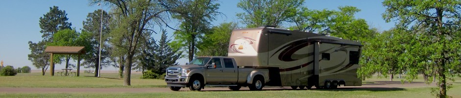
When we pulled in to our site, a couple of the neighbors came over to admire the Majestic. One of them said that it looked just like the pictures in Trailer Life.

I talked with my cousin Jan today. Ken's birthday is tomorrow, and hers is Wednesday, so I wished her a happy birthday. We'll be near Phoenix the end of May and first part of June before going to the Grand Canyon, so we'll have an opportunity to visit. Jan has a friend named Larry, whom she met at Sal's. He's also a realtor, and they each have two cats, so it sounds like they are very simpatico! Read more!

Monday, May 12, 2014

Inscriptions and a Cinder Cone

Today we set out to travel south on NM 53 to visit and hike at the El Calderon area of El Malpais and the El Morro National Monument. We knew it would be rather cold, but the wind would be less of a problem than it was yesterday.

We stopped at the NPS Information Center and picked up some brochures and then went on to El Morro National Monument (El Morro is Spanish for "the promontory"). People also refer to it as Inscription Rock, because of the petroglyphs and inscriptions left by Ancestral Puebloans, Spanish explorers, and Anglo settlers on their way to California.


This place has attracted both people and animals for millennia, partly because the pool at the base provides a reliable water source, very important in this desert landscape.


We took the half mile trail around the base of Inscription Rock, with a laminated flip chart showing only a few of the nearly 2,000 inscriptions. Many are faded or otherwise difficult to see, and it was easier when we had some clue what we were looking for.


We intended to walk the two-mile trail on top of the bluff, but the icy wind froze our fingers, and we knew we would be even more exposed to the wind if we climbed up on the rock. We decided to leave and go to the Ancient Way Cafe for lunch. The young woman we had met on the Narrows Rim Trail a couple of days ago recommended it. We wanted to get something warm and stay inside long enough to thaw our fingers, so we saved our packed lunch to have for supper later.

Highway 53 is known as the Ancient Way, which explains the name of the cafe.

The Ancient Way Cafe is a unique place to enjoy a slow cooked breakfast or lunch made and served with love. On Friday and Saturday evenings gourmet dinners are limited to one special dish planned and prepared by our chefs with a different theme each week.
We had some delicious hot coffee while we perused the menu and waited for our food to arrive. We had the soup of the day, homemade tomato basil, and split a wonderful sandwich that featured turkey, avocado, bacon and sauce on homemade bread. All yummy and a great place to slow down and warm up.

Next we went to the El Calderon area. We found some handwarmers in the truck and broke them out. We visited Junction Cave, a cave formed by a lava tube. We had picked up a free cave permit earlier. We didn't plan to go in very far. This was definitely our first descent into a wild cave, involving boulder scrambling and watching out for loose rocks and dark dropoffs. We didn't get very far from the entrance, but it was enough to get some sense of what actual spelunking would be like.


My puny little flashlight didn't reach very far, and I soon became aware that a headlamp would be a definite asset. I needed both hands to scramble over the rocks.

We went on to complete the three-mile hike out to El Calderon cinder cone and back. The sun was out part of the time, and we were mostly somewhat protected from the wind, but our hand warmers were still nice to have in our pockets.


Read more!

Sunday, May 11, 2014

Happy Mother's Day

I heard from all my sweet kids today--thanks! Terri sent me a virtual orchid from the Gardens by the Bay's Cloud Forest. Molly took her there today. Chris posted a pic of me from 1966, when he was just a little thing, and Julie posted a pic of me with Cate and Sam, also from years ago (though not as many!) and a pic of the Shaffer kids (Chris, Terri, and Ed) with me.

Sadly, my mom is no longer with us. I miss her so. She passed away just before Mother's Day in 2007.

Photo: Love

 CatesFirstBaseballGame009.jpg Photo:  This Photo was uploaded by julieshaffer24. Find other CatesFirstBaseballGame009.jpg pictures and photos or upload y...

CatesFirstBaseballGame009.jpg Photo:  This Photo was uploaded by julieshaffer24. Find other CatesFirstBaseballGame009.jpg pictures and photos or upload y...
We decided to take a day off from hiking and sightseeing. The weather forecast just didn't look good for outdoor activities. The wind is really kicking up the sand and dust. Instead we did our laundry and grocery shopping, so now we have clean clothes and food in the fridge.

The weather icons actually show a slight chance of snow around here the next two days. Brrr! We'll have to bundle up to go out tomorrow.


Read more!

Saturday, May 10, 2014

Heading South and Out on the Lava

We headed south on Hwy 117 again today. We stopped at the BLM primitive campground called Joe Skeen Campground. The road in has a large steep dip that would certainly prevent us from taking the Majestic in--we'd bottom out for sure. There are ten sites with picnic tables under shelters, fire rings, and great views. Some of them would actually be okay for a longer rig. The BLM is looking for volunteer hosts for this campground.

We left Hwy 117 to turn south on Cibola County Road #41. Some friends of ours have a place about seventeen miles down this dirt road. They aren't in residence right now but invited us to check out their little corner of remote paradise. Boy is it remote! Most of the road is washboarded, so it made for a rather slow and uncomfortable ride. However, once we got to their place, the views were wonderful. Looking south, you can see the Sawtooth Mountains.


After a picnic lunch, we headed back north into El Malpais again to hike the Lava Falls Trail. It's a relatively short one mile circular trail with one spur. The trail is marked by cairns, but they are often difficult to find. The sign at the head of the trail cautions hikers not to leave one cairn before sighting the next, so one of us always stayed at the last known cairn while the other scouted to find the next cairn. At one point after signpost #3 (keyed to an informative brochure about the trail) we could not find the next cairn and so had to head back to the parking lot.


We decided to try following the trail in the clockwise direction and had more success, until we came to a cairn at the base of a steep cliff that seemed to be a dead end, so we returned to the truck again. We decided to call it a day. Now we realize that the dead end was actually on the spur trail and that we missed the junction where the trail split. Part continued in the counterclockwise direction--the part we missed seeing--and another part led on a spur into a deep amphitheater.

Despite missing part of the trail, we are very glad we took this hike. As you can see, the lava fields are extremely varied. There's smooth, often ropy lava called pahoehoe (from the Hawaiian). Some lava has been weathered into loose pieces rather like the rocks in a barbecue grill. Some of the lava forms deep cavities, while other parts are uplifted.

Deep fissures mark the terrain. It's an impressive, unfamiliar landscape. It reminded us of hiking at Volcanoes National Park on the Big Island, except that the youngest lava here in the McCartys flow is around 3,000 years old. No smoke and smell of brimstone emanates from this lava, and it doesn't threaten to melt your shoes!

 Nonetheless, it can be treacherous footing. The sign at the trailhead warns, "This isn't your typical walk in the park," and suggests sturdy hiking shoes and plenty of water. It says a GPS unit would be useful, since magnetic compasses are thrown off by the iron content of much of the lava.


Typical cairn.

Lava cracked and buckled with a large sink hole.

Life will always find a way!


That's Ken out taking photos on the lava--or maybe he's trying to locate the next cairn?

We didn't get back home until after 7:00 p.m., tired but happy, and very hungry. The weather forecast for tomorrow is not promising, so we've decided to take the day off from sightseeing and instead do our laundry and shopping and catch up with ourselves.

We watched a PBS Arts special tonight: Jake Shimabukuro: Life on Four String. It's about a ukelele virtuoso, but really delves into Jake's life, the development of his music, and the human story behind his musical career. For example, it shows Jake accompanying his (now former) manager, Kaz Flanagan, to her hometown in Japan, Sendai, which was completely destroyed by the tsunami Read more!

Friday, May 9, 2014

El Malpais

Thought for today:  
Travel ennobles the spirit and does away with our prejudices.
Oscar Wilde

This bird serenaded us through breakfast this morning. We think it's a Brown Thrasher or possibly a Curve-billed Thrasher.


We packed a lunch and headed out, first to the Grants Post Office to pick up our General Delivery mail and a gas station to fill up with diesel. Then we took Hwy 117 south into El Malpais, which is the name of the National Conservancy Area (BLM) and the National Monument (NPS).

Our first stop was at the BLM Ranger Station, where a friendly volunteer showed us a video and gave us some informative handouts. From there we went south to the Sandstone Bluffs, where we could see some spectacular views of the lava field and  cinder cones.


Then we drove on farther south to La Ventana, a large and quite impressive natural arch.


Farther south we came to the South Narrows Picnic Area. The Narrows are so called because there is only a thin strip of land between the sandstone bluffs to the east and the McCarty lava flow to the west. We ate our lunch at one of the five covered picnic tables and then started up the Narrows Rim Trail. The trail is marked by stone cairns and pretty well traveled, so it wasn't too hard to follow. As the name implies, it runs along the edge of the sandstone bluffs overlooking the Narrows.


The trail stays a safe distance in from the rim, but you can approach more closely at several vantage points. The wind picked up quite a bit while we were out on the trail, so we were cautious about going near the edge.

If you hike the entire trail, it's just over four miles out to a vantage point where you can see the Ventana Arch from above. We didn't go that far. It was late afternoon, and the footing is rough and rocky, so slow going. We went far enough to enjoy some spectacular views of the vast lava flows and the multicolored bluffs.

One young woman jogged past us on the trail, but we didn't see anyone else. She caught up with us again just as we were descending to the trail head. We chatted briefly. She lives in the area and hikes (or jogs) this trail about once a month.


Read more!